 Library
The presentations, maps, and documents provided below relate to the formation of the Upper Ventura River Groundwater Sustainability Agency. Other relevant library resources can be found in the sidebar.
Administrative Documents
Fiscal Year 2023-2024 Fiscal Audit
Fiscal Year 2024-2025 Adopted Budget
Monitoring Reports
Groundwater Level Monitoring Reports
Water Year 2024/2025 Groundwater Level Data Memorandum
Water Year 2023/2024 Groundwater Level Data Memorandum
Water Year 2022/2023 Groundwater Level Data Memorandum
Water Year 2022/2023 October-April Semi-Annual Groundwater Level Data Water Year
Water Year 2021/2022 Groundwater Level Data Report
Water Year 2020/2021 Groundwater Level Data Report
Water Year 2019/2020 Groundwater Level Data Report
Second Annual GW Level Data Report for Water Year 2019
First Annual GW Level Data Report for Spring 2017-Summer 2018
Surface Water Flow Monitoring Reports
Water Year 2024/2025 Camino Cielo Streamflow Data Memorandum
Water Year 2024/2025 Visual Surface Water Monitoring Data Memorandum
Water Year 2023/2024 Camino Cielo Streamflow Data Memorandum
Water Year 2023/2024 Visual Surface Water Monitoring Data Memorandum
Water Year 2022/2023 Camino Cielo Streamflow Data Memorandum
Water Year 2022/2023 Visual Surface Water Monitoring Data Memorandum
Deliverable Memorandum Ventura River Visual Monitoring Report for Water Year 2022
First Annual Ventura River Flow Limits Location Report for Water Year 2019
First Annual Surface Water Flow Report for Water Year 2019
Groundwater Dependent Ecosystem Monitoring Reports
Water Year 24/25 Aquatic GDE Monitoring Data Memorandum and 3-Year Review
Water Year 24/25 Riparian GDE Data Memorandum
Water Year 23/24 Aquatic GDE Monitoring Data Memorandum
Water Year 23/24 Riparian GDE Data Memorandum
Water Year 2022/2023 Riparian Groundwater Dependent Ecosystems Monitoring
Water Year 2022/2023 Aquatic Groundwater Dependent Ecosystems Monitoring
2021/2022 Riparian GDE Monitoring Report
Other Documents
UVRGA GSP Grant Task 4 GW Extraction Use Estimates and Well Inventory Me…
Please click on the link below to view the final JPA for the Upper Ventura Basin GSA.
UVRB JPA Agreement for the Upper Ventura River GroundwaterAgency FINA….
Final Data Quality Control Review Procedure Adopted 9-13-18
UVRGA Monitoring Protocols – Adopted 9-13-18
UVRGA Monitoring Protocols Adopted 5-10-18
Surface & Groundwater-B.Kuebler
2014 Annual Report of Groundwater Conditions (Ventura County Watershed Protection District)
California’s Groundwater: Bulletin 118 (California Department of Water Resources)
Draft Environmental Impact Report, Ventura River Conjunctive Use Agreement, Part 1, 1978 (EDAW)
GeoHydrology of the Ventura River System: Ground Water Hydrology, 1971 and Plates
(Ventura County Flood Control District)
Groundwater Budget and Approach to a Groundwater Management Plan, Upper and Lower Ventura River Basin (Daniel B. Stephens & Associates)
Hydrologic Assessment, San Antonio Creek Sub-Watershed, 2006 (Daniel B. Stephens & Associates)
Natural Condition Report, Ventura River Watershed Hydrology Model, 2009 (Tetra Tech)
Pumping Interference Data Modeling Report, 2014 (Kear)
Ventura River Watershed Management Plan, 2015 (Walter)
Ventura River Watershed Protection Plan Report, 2012 (Cardno Entrix)
UVRGA Comment Letter on CDFW Draft Instream Flow Recommendations
Presentations
UVRGA Executive Director SGMA Overview Presentation to VRWC 6/4/20
A Year in the Life of the Upper Ventura River Groundwater Basin
Kear Groundwater 10/12/17 Presentation “In Search of the Live Reach”
01/28/2016 Stakeholder Meeting, SGMA Act Overview (Clifford)
01/28/2016 Stakeholder Meeting, GSA Agencies (Wickstrum)
01/28/2016 Stakeholder Meeting, Boundary Modification (Kear)
04/23/2015 Stakeholder Meeting, GSA Overview (Kuebler)
Newsletters
Maps
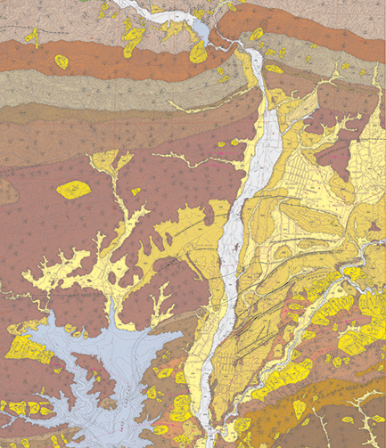
The four maps below show the existing and proposed boundaries of the Upper Ventura River Basin.
Upper Ventura River Groundwater Basin Boundary (Existing & Proposed), Aerial
Upper Ventura River Groundwater Basin Boundary (Existing & Proposed), Geology
Upper Ventura River Groundwater Basin Boundary (Existing & Proposed), Parcel
Upper Ventura River Groundwater Basin Boundary (Existing & Proposed), US Topo
Public Agencies of the Upper Ventura River Groundwater Sustainability Agency
Ventura River Watershed Resources
Map Atlas
Document Library
Presentation Library
Watershed Management Plan